Geolocate

Aosta topographic map

Click on the map to display elevation.

About this map
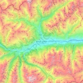
Name: Aosta topographic map, elevation, terrain.

Location: Aosta, Aosta / Aoste, Aosta Valley, 11100, Italy (45.57709 7.15966 45.89709 7.47966)

Average elevation: 1,992 m

Minimum elevation: 484 m

Maximum elevation: 3,932 m

Gear up for your next adventure:

🥘Camping Cookware Set - Compact nesting pots and pans for trail cooking
🥾Trail Hiking Socks - Comfortable socks to prevent blisters and fatigue
🔋Emergency Crank Radio - Weather alerts and power without needing batteries
🧭GPS Handheld Device - Reliable GPS navigation for outdoor adventures
🛌Down Sleeping Bag - Superior warmth-to-weight ratio for cold nights

As an Amazon Associate, this site earns from qualifying purchases at no extra cost to you.