Geolocate

Messick topographic map

Click on the map to display elevation.

About this map

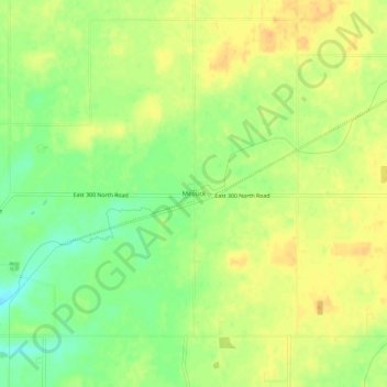
Name: Messick topographic map, elevation, terrain.

Location: Messick, Henry County, Indiana, United States (39.95532 -85.32275 39.99532 -85.28275)

Average elevation: 334 m

Minimum elevation: 315 m

Maximum elevation: 347 m

Other topographic maps

Click on a map to view its topography, its elevation and its terrain.

New Castle

United States > Indiana > Henry County

Average elevation: 323 m

Mooreland

United States > Indiana > Henry County

Average elevation: 344 m

New Castle

United States > Indiana > Henry County

Average elevation: 323 m

Gear up for your next adventure:

🧥Ultralight Puffy Jacket - Maximum warmth that packs down to the size of an orange
🛶Canoe Life Vest - Safety vest for water sports
🥾Lightweight Hiking Boots - Boots for comfort and mobility on long hikes
🧤Insulated Winter Gloves - Heavy-duty protection for sub-zero Canadian adventures
👟Trail Running Shoes - Agile footwear for fast-paced topographic exploration

As an Amazon Associate, this site earns from qualifying purchases at no extra cost to you.