
晋安区 topographic map
Interactive map
Click on the map to display elevation.
About this map
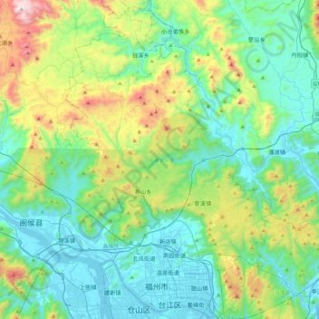
Name: 晋安区 topographic map, elevation, terrain.
Location: 晋安区, 福州市, 福建省, 中国 (26.03842 119.17151 26.41480 119.44282)
Average elevation: 323 m
Minimum elevation: -1 m
Maximum elevation: 1,382 m
Other topographic maps
Click on a map to view its topography, its elevation and its terrain.