
吴航街道 topographic map
Interactive map
Click on the map to display elevation.
About this map
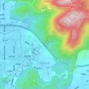
Name: 吴航街道 topographic map, elevation, terrain.
Location: 吴航街道, 长乐区, 福州市, 福建省, 中国 (25.94724 119.50297 25.98532 119.53850)
Average elevation: 141 m
Minimum elevation: 1 m
Maximum elevation: 560 m
Other topographic maps
Click on a map to view its topography, its elevation and its terrain.