
Barhan topographic map
Click on the map to display elevation.
About this map
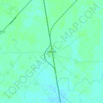
Name: Barhan topographic map, elevation, terrain.
Location: Barhan, Etmadpur, Agra District, Uttar Pradesh, 283201, India (27.29239 78.15067 27.37239 78.23067)
Average elevation: 171 m
Minimum elevation: 168 m
Maximum elevation: 175 m
Other topographic maps
Click on a map to view its topography, its elevation and its terrain.
Jewar
Jewar is located at 28°07′N 77°20′E / 28.12°N 77.33°E / 28.12; 77.33. It has an average elevation of 195 metres (640 ft). It is located between 28.13° north latitude and 77.55° east longitude at an elevation of 195 metres (640 ft). It is on the northeast bank of the Yamuna River.
Average elevation: 195 m
Kannauj
Kannauj is located at 27°04′N 79°55′E / 27.07°N 79.92°E / 27.07; 79.92. It has an average elevation of 139 metres (456 feet).
Average elevation: 141 m
Bahraich
Topography: The district's terrain is characterized by a mix of plain and hilly areas. The northern part of the district, bordering Nepal, is mountainous and forms a part of the foothills of the Himalayas. The southern part is predominantly plain, formed by the Gangetic alluvial plains.
Average elevation: 194 m
Sitapur
Sitapur is located at 27.57°N 80.68°E. It test has an average elevation of 138 meters (452 feet). It is located in the Gangetic Plain, with elevations ranging from 150 m above sea level in the north-west to 100 m in the south-east. It is intersected by numerous streams and ravines and contains many shallow…
Average elevation: 131 m