Geolocate

Gola topographic map

Click on the map to display elevation.

About this map

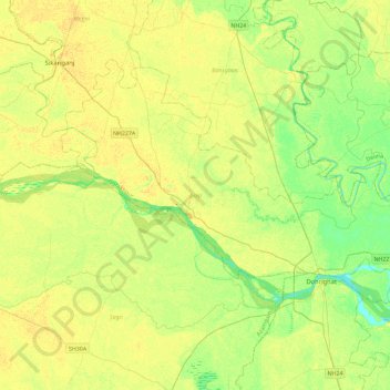
Name: Gola topographic map, elevation, terrain.

Location: Gola, Gorakhpur, Uttar Pradesh, India (26.22089 83.20146 26.50873 83.66195)

Average elevation: 75 m

Minimum elevation: 62 m

Maximum elevation: 86 m

Other topographic maps

Click on a map to view its topography, its elevation and its terrain.

Barhalganj

India > Uttar Pradesh > Gola > Barhalganj

Average elevation: 72 m

Gear up for your next adventure:

🥽Outdoor Goggles - Protective eyewear for outdoor activities
🚲MTB Frame Bag - Carry tools and maps directly on your bicycle frame
🧼Travel Hand Sanitizer - Keep hands clean when water is scarce
🥾Lightweight Hiking Shoes - Comfortable shoes for day hikes
Camping Coffee Maker - Brew fresh coffee anywhere on the topographic map

As an Amazon Associate, this site earns from qualifying purchases at no extra cost to you.