Geolocate

Sahibabad topographic map

Click on the map to display elevation.

About this map

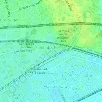
Name: Sahibabad topographic map, elevation, terrain.

Location: Sahibabad, Ghaziabad District, Uttar Pradesh, India (28.66902 77.36738 28.67367 77.37712)

Average elevation: 208 m

Minimum elevation: 202 m

Maximum elevation: 218 m

Gear up for your next adventure:

🔦LED Headlamp - Hands-free lighting for early morning starts or late finishes
🥤Collapsible Travel Cup - Saves space and weight in your mess kit
💧Hydration Pack - Hands-free hydration system for long hikes
🥾Trail Running Shoes - Lightweight and durable shoes for trail running
🧥Ultralight Puffy Jacket - Maximum warmth that packs down to the size of an orange

As an Amazon Associate, this site earns from qualifying purchases at no extra cost to you.