Geolocate

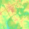
Bowling Green topographic map

Click on the map to display elevation.

About this map

Name: Bowling Green topographic map, elevation, terrain.

Location: Bowling Green, Caroline County, Virginia, United States (38.03746 -77.36126 38.07040 -77.32994)

Average elevation: 58 m

Minimum elevation: 34 m

Maximum elevation: 73 m

Other topographic maps

Click on a map to view its topography, its elevation and its terrain.
Balty

United States > Virginia > Caroline County

Average elevation: 61 m

Ruther Glen

United States > Virginia > Caroline County

Average elevation: 66 m

Corbin

United States > Virginia > Caroline County

Average elevation: 56 m

Corbin

United States > Virginia > Caroline County

Average elevation: 56 m

Athens

United States > Virginia > Caroline County

Average elevation: 60 m

Ladysmith

United States > Virginia > Caroline County

Average elevation: 70 m

Gear up for your next adventure:

🥾Mountain Hiking Shoes - Shoes with superior grip for mountainous terrain
🧊Insulated Water Bottle - Keeps drinks cold in summer and prevents freezing in winter
🎒Backpack Rain Cover - External shield to keep your entire pack dry
🧣Evaporative Cooling Towel - Beat the heat during intense summer climbs
🥤Collapsible Travel Cup - Saves space and weight in your mess kit

As an Amazon Associate, this site earns from qualifying purchases at no extra cost to you.