Geolocate

Corbin topographic map

Click on the map to display elevation.

About this map

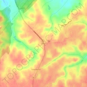
Name: Corbin topographic map, elevation, terrain.

Location: Corbin, Caroline County, Virginia, 22446, United States (38.17957 -77.40887 38.21957 -77.36887)

Average elevation: 56 m

Minimum elevation: 21 m

Maximum elevation: 73 m

Other topographic maps

Click on a map to view its topography, its elevation and its terrain.

Gear up for your next adventure:

🥾Approach Shoes - Shoes designed for climbing approaches and rugged trails
🚲Heavy Duty Bike Lock - Secure your bike at the trailhead or during stops
🥽Outdoor Goggles - Protective eyewear for outdoor activities
🧥Ultralight Puffy Jacket - Maximum warmth that packs down to the size of an orange
🪜Heavy Duty Carabiners - Multi-use clips for securing gear to your backpack

As an Amazon Associate, this site earns from qualifying purchases at no extra cost to you.