Geolocate

Athens topographic map

Click on the map to display elevation.

About this map

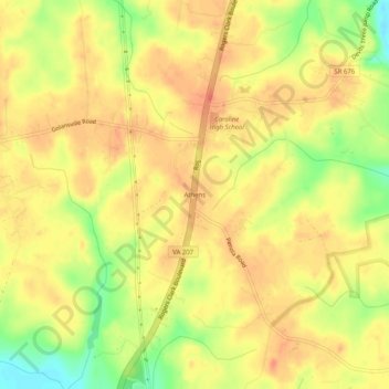
Name: Athens topographic map, elevation, terrain.

Location: Athens, Caroline County, Virginia, United States (37.97264 -77.43720 38.01264 -77.39720)

Average elevation: 60 m

Minimum elevation: 25 m

Maximum elevation: 79 m

Other topographic maps

Click on a map to view its topography, its elevation and its terrain.

Gear up for your next adventure:

🧴Waterproofing Spray - Restore the DWR coating on jackets and tents
🎒Hiking Backpack - Lightweight and ergonomic backpacks for day hikes or multi-day treks
🔦LED Flashlight - Powerful and long-lasting flashlight for camping and emergencies
🥫Freeze-Dried Meals - Lightweight, high-calorie nutrition for multi-day treks
🧴First Aid Kit - Essential first aid supplies for outdoor emergencies

As an Amazon Associate, this site earns from qualifying purchases at no extra cost to you.