
Ladysmith topographic map
Click on the map to display elevation.
About this map
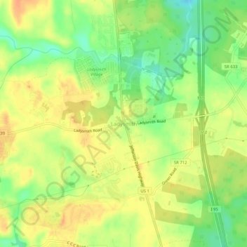
Name: Ladysmith topographic map, elevation, terrain.
Location: Ladysmith, Caroline County, Virginia, 22501, United States (37.99764 -77.53526 38.03764 -77.49526)
Average elevation: 70 m
Minimum elevation: 48 m
Maximum elevation: 85 m
Other topographic maps
Click on a map to view its topography, its elevation and its terrain.