Geolocate

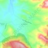
Uruapan topographic map

Click on the map to display elevation.

About this map

Name: Uruapan topographic map, elevation, terrain.

Location: Uruapan, Michoacán, Mexico (19.18496 -102.39363 19.62749 -101.93616)

Average elevation: 1,786 m

Minimum elevation: 459 m

Maximum elevation: 3,340 m

Other topographic maps

Click on a map to view its topography, its elevation and its terrain.
Zacapu

Mexico > Michoacán > Zacapu

Average elevation: 2,262 m

Villa Morelos

Mexico > Michoacán > Morelos > Villa Morelos

Average elevation: 2,352 m

La Yerbabuena

Mexico > Michoacán > Tlazazalca

Average elevation: 1,911 m

Jesús del Monte

Mexico > Michoacán > Morelia

Average elevation: 2,136 m

Chaparaco

Mexico > Michoacán > Zamora

Average elevation: 1,624 m

Zurumbeneo

Mexico > Michoacán > Zurumbeneo

Average elevation: 2,029 m

Ihuatzio

Mexico > Michoacán > Tzintzuntzan

Ihuatzio is located on the southeast of the Lake Pátzcuaro, about 8 kilometers southwest of the town center of Tzintzuntzan. Its average elevation is 2,052 meters above the sea level.

Average elevation: 2,052 m
Las Cieneguitas

Mexico > Michoacán > Tanhuato

Average elevation: 1,567 m

Gear up for your next adventure:

🛌Down Sleeping Bag - Superior warmth-to-weight ratio for cold nights
🧢Beanie Hat - Keep your head warm in cold weather
🧴Bear Spray Holster - Quick-access carry for essential Canadian wilderness safety
🩹Compact First Aid Kit - Pre-packed essentials for common trail injuries
🛏️Camping Sleeping Mat - Comfortable mats for sleeping outdoors

As an Amazon Associate, this site earns from qualifying purchases at no extra cost to you.