Geolocate

Chaparaco topographic map

Click on the map to display elevation.

About this map

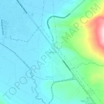
Name: Chaparaco topographic map, elevation, terrain.

Location: Chaparaco, Zamora, Michoacán, 59669, Mexico (19.94012 -102.27985 19.98012 -102.23985)

Average elevation: 1,624 m

Minimum elevation: 1,566 m

Maximum elevation: 1,894 m

Gear up for your next adventure:

🥾Mountain Hiking Shoes - Shoes with superior grip for mountainous terrain
🧢Sun Protection Cap - Breathable cap to protect from sun exposure
🥾Mountain Trail Shoes - High-traction shoes for mountain trails
Lightweight Camping Tent - Portable shelter optimized for Canadian backcountry camping
🥾Waterproof Hiking Boots - Essential footwear for rugged terrain and wet Canadian trails

As an Amazon Associate, this site earns from qualifying purchases at no extra cost to you.