Geolocate

Dayap topographic map

Click on the map to display elevation.

About this map

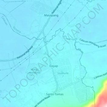
Name: Dayap topographic map, elevation, terrain.

Location: Dayap, Calauan, Laguna, Calabarzon, 4012, Philippines (14.16703 121.31498 14.19242 121.34985)

Average elevation: 19 m

Minimum elevation: 4 m

Maximum elevation: 223 m

Other topographic maps

Click on a map to view its topography, its elevation and its terrain.

Mount Mabilog

Philippines > Laguna > Calauan

Average elevation: 152 m

Balayhangin

Philippines > Laguna > Calauan

Average elevation: 87 m

Kalisungan

Philippines > Laguna > Calauan

Average elevation: 293 m

Lamot 2

Philippines > Laguna > Calauan

Average elevation: 110 m

Imoc Hill

Philippines > Laguna > Calauan

Average elevation: 148 m

Gear up for your next adventure:

Camping Tent - Weather-resistant tents suitable for 2 to 6 people
🥾Trail Running Shoes - Lightweight and durable shoes for trail running
🧦Hiking Liner Socks - Thin base layer to prevent friction and blisters
🥾Mountain Hiking Boots - High-traction boots for rocky terrain
🧴Waterproofing Spray - Restore the DWR coating on jackets and tents

As an Amazon Associate, this site earns from qualifying purchases at no extra cost to you.