Geolocate

Kalisungan topographic map

Click on the map to display elevation.
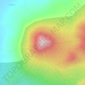
About this map

Name: Kalisungan topographic map, elevation, terrain.

Location: Kalisungan, Calauan, Laguna, Calabarzon, 4012, Philippines (14.14707 121.34453 14.14717 121.34463)

Average elevation: 293 m

Minimum elevation: 27 m

Maximum elevation: 637 m

Other topographic maps

Click on a map to view its topography, its elevation and its terrain.

Dayap

Philippines > Laguna > Calauan

Average elevation: 19 m

Silangan

Philippines > Laguna > Calauan

Average elevation: 24 m

Mabacan

Philippines > Laguna > Calauan

Average elevation: 34 m

Perez

Philippines > Laguna > Calauan

Average elevation: 82 m

Masiit

Philippines > Laguna > Calauan

Average elevation: 12 m

Imoc

Philippines > Laguna > Calauan

Average elevation: 125 m

Masiit

Philippines > Laguna > Calauan

Average elevation: 12 m

Masiit

Philippines > Laguna > Calauan

Average elevation: 12 m

Mabacan

Philippines > Laguna > Calauan

Average elevation: 34 m

Perez

Philippines > Laguna > Calauan

Average elevation: 82 m

Gear up for your next adventure:

Camping Tent - Weather-resistant tents suitable for 2 to 6 people
🥾Light Trekking Boots - Supportive boots for multi-day treks
🛌Insulated Sleeping Pad - Critical thermal barrier between you and the cold ground
🧦Crew Hiking Socks - Comfortable socks for long-distance hikes
🎒Hiking Daypack - Lightweight and durable backpacks for day trips and excursions

As an Amazon Associate, this site earns from qualifying purchases at no extra cost to you.