Geolocate

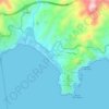
Guía de Isora topographic map

Click on the map to display elevation.

About this map

Name: Guía de Isora topographic map, elevation, terrain.

Location: Guía de Isora, Santa Cruz de Tenerife, Canary Islands, Spain (28.15643 -16.84033 28.27396 -16.67552)

Average elevation: 785 m

Minimum elevation: 0 m

Maximum elevation: 2,247 m

Other topographic maps

Click on a map to view its topography, its elevation and its terrain.
Barcelona

Spain > Catalonia > Barcelonès > Barcelona

Average elevation: 65 m

Priédamu

Spain > Asturias > Llanes

Average elevation: 422 m

Praia de Queiruga

Spain > Galicia > Noia > As Chamosas

Average elevation: 45 m

Pimiango

Spain > Asturias > Ribadedeva

Average elevation: 56 m

Bel-Air

Spain > Andalusia > Costa del Sol Occidental > Estepona

Average elevation: 35 m

Mondrón

Spain > Andalusia > La Axarquía > Periana

Average elevation: 576 m

Ganbella

Spain > Pirinioaurrea / Prepirineo > Unciti

Average elevation: 948 m

Cortiguera

Spain > Castile and León > El Bierzo

Average elevation: 552 m

Pico Mazo

Spain > Castile and León > Valle de Sedano

Average elevation: 802 m

Arnao

Spain > Castrillón > Piedrasblancas

Average elevation: 25 m

Refugi de la Restanca

Spain > Catalonia > Val d'Aran

Average elevation: 2,161 m

Los Solaines

Spain > Valencian Community > Villena

Average elevation: 690 m

Gear up for your next adventure:

🎒Hiking Daypack - Lightweight and durable backpacks for day trips and excursions
🧦Thermal Socks - Warm socks for winter hiking or camping
🔭Outdoor Binoculars - Lightweight binoculars for birdwatching and hiking
🧼Travel Hand Sanitizer - Keep hands clean when water is scarce
🧭GPS Tracker - Track your location in remote areas safely

As an Amazon Associate, this site earns from qualifying purchases at no extra cost to you.