Geolocate

Mondrón topographic map

Click on the map to display elevation.

About this map

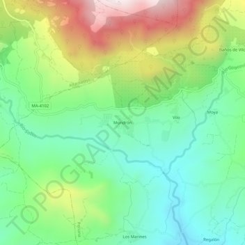
Name: Mondrón topographic map, elevation, terrain.

Location: Mondrón, Periana, La Axarquía, Malaga, Andalusia, 29710, Spain (36.91961 -4.24801 36.95961 -4.20801)

Average elevation: 576 m

Minimum elevation: 291 m

Maximum elevation: 1,104 m

Gear up for your next adventure:

🧼Biodegradable Camp Soap - Environmentally friendly cleaning for gear and body
🥾Waterproof Trail Shoes - Shoes designed to handle wet terrain
💧Collapsible Water Bottle - Space-saving water bottle for outdoor activities
🥾Durable Hiking Shoes - Long-lasting shoes for frequent hiking
🥾Light Hiking Boots - Lightweight and comfortable boots for day hikes

As an Amazon Associate, this site earns from qualifying purchases at no extra cost to you.