Geolocate

Ganbella topographic map

Click on the map to display elevation.

About this map

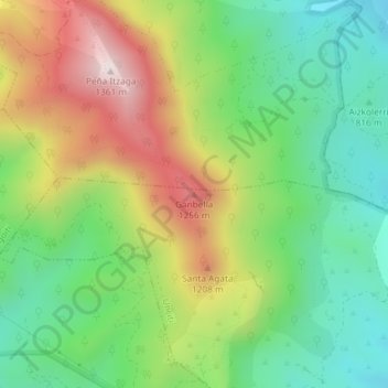
Name: Ganbella topographic map, elevation, terrain.

Location: Ganbella, Unciti, Pirinioaurrea / Prepirineo, Spain (42.70362 -1.42208 42.70372 -1.42198)

Average elevation: 948 m

Minimum elevation: 684 m

Maximum elevation: 1,350 m

Gear up for your next adventure:

💡Compact LED Flashlight - Powerful and portable flashlight for outdoor use
🧥Ultralight Puffy Jacket - Maximum warmth that packs down to the size of an orange
🥾Hiking Leggings - Comfortable leggings for outdoor activities
🛶Waterproof Dry Bags - Keep electronics and clothes dry during river crossings
🥾Approach Boots - Comfortable boots for hiking and climbing approaches

As an Amazon Associate, this site earns from qualifying purchases at no extra cost to you.