Geolocate

Pimiango topographic map

Click on the map to display elevation.

About this map

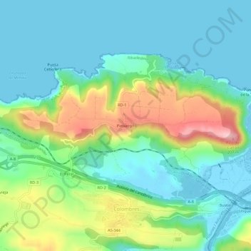
Name: Pimiango topographic map, elevation, terrain.

Location: Pimiango, Ribadedeva, Asturias, 39560, Spain (43.36820 -4.56115 43.40820 -4.52115)

Average elevation: 56 m

Minimum elevation: -6 m

Maximum elevation: 198 m

Gear up for your next adventure:

🧭Orienteering Kit - Tools for map reading and navigation in the wild
🧦Hiking Liner Socks - Thin base layer to prevent friction and blisters
🦶Anti-Blister Balm - Prevents friction and hotspots during long ascents
👖Convertible Hiking Pants - Zip-off legs to adapt to changing weather conditions
🧴Sunscreen SPF - Broad-spectrum sunscreen for outdoor activities

As an Amazon Associate, this site earns from qualifying purchases at no extra cost to you.