Geolocate

Finnmark topographic map

Click on the map to display elevation.

About this map

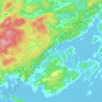
Name: Finnmark topographic map, elevation, terrain.

Location: Finnmark, Bamble, Vestfold og Telemark, 3967, Norway (58.92351 9.56336 58.96351 9.60336)

Average elevation: 38 m

Minimum elevation: -1 m

Maximum elevation: 139 m

Other topographic maps

Click on a map to view its topography, its elevation and its terrain.

Midt-Telemark

Norway > Vestfold og Telemark

Average elevation: 360 m

Fyresdal

Norway > Vestfold og Telemark

Average elevation: 693 m

Bordalsvatn

Norway > Vestfold og Telemark

Average elevation: 1,017 m

Kviteseid

Norway > Vestfold og Telemark

Average elevation: 594 m

Nissedal

Norway > Vestfold og Telemark

Average elevation: 500 m

Gear up for your next adventure:

🥾All-Terrain Hiking Boots - Versatile boots for varied hiking conditions
🪜Heavy Duty Carabiners - Multi-use clips for securing gear to your backpack
💧Collapsible Water Bottle - Space-saving water bottle for outdoor activities
🧣Merino Neck Gaiter - Protects against wind, sun, and cold at high altitudes
🛌Insulated Sleeping Pad - Critical thermal barrier between you and the cold ground

As an Amazon Associate, this site earns from qualifying purchases at no extra cost to you.