Geolocate

Nissedal topographic map

Click on the map to display elevation.

About this map

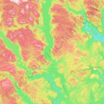
Name: Nissedal topographic map, elevation, terrain.

Location: Nissedal, Vestfold og Telemark, Norway (58.83140 8.28647 59.26727 8.83418)

Average elevation: 500 m

Minimum elevation: 76 m

Maximum elevation: 1,142 m

Other topographic maps

Click on a map to view its topography, its elevation and its terrain.

Larvik

Norway > Vestfold og Telemark

Average elevation: 45 m

Øvre Birtedalen

Norway > Vestfold og Telemark

Average elevation: 655 m

Kirkebygda

Norway > Vestfold og Telemark

Average elevation: 13 m

Torsberg

Norway > Vestfold og Telemark > Skien

Average elevation: 51 m

Finnmark

Norway > Vestfold og Telemark

Average elevation: 38 m

Treungen

Norway > Vestfold og Telemark

Average elevation: 357 m

Sauland

Norway > Vestfold og Telemark

Average elevation: 210 m

Valberg

Norway > Vestfold og Telemark

Average elevation: 57 m

Hof

Norway > Vestfold og Telemark

Average elevation: 97 m

Gear up for your next adventure:

🥾Trail Running Boots - Durable shoes designed for trail running
🧳Compression Sacks - Maximize space in your backpack by shrinking gear
💡Compact LED Flashlight - Powerful and portable flashlight for outdoor use
💡Solar Camping Lamp - Eco-friendly lighting for campsites
👟Trail Running Shoes - Agile footwear for fast-paced topographic exploration

As an Amazon Associate, this site earns from qualifying purchases at no extra cost to you.