Geolocate

Fyresdal topographic map

Click on the map to display elevation.

About this map

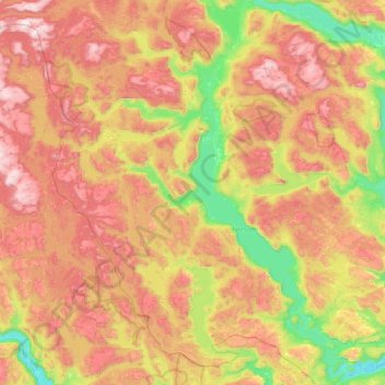
Name: Fyresdal topographic map, elevation, terrain.

Location: Fyresdal, Vestfold og Telemark, 3870, Norway (58.92863 7.69616 59.36040 8.40609)

Average elevation: 693 m

Minimum elevation: 189 m

Maximum elevation: 1,268 m

Other topographic maps

Click on a map to view its topography, its elevation and its terrain.

Larvik

Norway > Vestfold og Telemark

Average elevation: 45 m

Øvre Birtedalen

Norway > Vestfold og Telemark

Average elevation: 655 m

Kirkebygda

Norway > Vestfold og Telemark

Average elevation: 13 m

Torsberg

Norway > Vestfold og Telemark > Skien

Average elevation: 51 m

Finnmark

Norway > Vestfold og Telemark

Average elevation: 38 m

Treungen

Norway > Vestfold og Telemark

Average elevation: 357 m

Sauland

Norway > Vestfold og Telemark

Average elevation: 210 m

Valberg

Norway > Vestfold og Telemark

Average elevation: 57 m

Hof

Norway > Vestfold og Telemark

Average elevation: 97 m

Gear up for your next adventure:

🧢Sun Protection Cap - Breathable cap to protect from sun exposure
🧥Softshell Hiking Jacket - The perfect balance of wind protection and breathability
🔦UV Flashlight - Detect minerals or specific insects in the dark
🦶Hiking Shoe Insoles - Added support for high arches and long days on feet
🔨Vehicle Emergency Tool - Safety tool for remote road trips to trailheads

As an Amazon Associate, this site earns from qualifying purchases at no extra cost to you.