
Idre fjäll topographic map
Interactive map
Click on the map to display elevation.
About this map
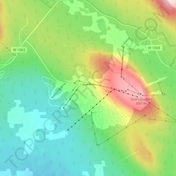
Name: Idre fjäll topographic map, elevation, terrain.
Location: Idre fjäll, Älvdalens kommun, Dalarna County, Sweden (61.86961 12.81307 61.90961 12.85307)
Average elevation: 677 m
Minimum elevation: 555 m
Maximum elevation: 917 m
Other topographic maps
Click on a map to view its topography, its elevation and its terrain.
Västanvik
Västanvik, Leksands kommun, Dalarna County, 793 92, Sweden
Average elevation: 226 m
Malung
Malung, Malung-Sälens kommun, Dalarna County, 782 31, Sweden
Average elevation: 341 m
Sälen
Sälen, Malung-Sälens kommun, Dalarna County, Sweden
Average elevation: 514 m
Tyngsjö
Tyngsjö, Malung-Sälens kommun, Dalarna County, Sweden
Average elevation: 344 m