Geolocate

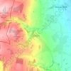
Broseley topographic map

Click on the map to display elevation.

About this map

Name: Broseley topographic map, elevation, terrain.

Location: Broseley, Shropshire, England, United Kingdom (52.59736 -2.48888 52.62508 -2.42729)

Average elevation: 142 m

Minimum elevation: 38 m

Maximum elevation: 218 m

Other topographic maps

Click on a map to view its topography, its elevation and its terrain.
Selattyn

United Kingdom > England > Shropshire

Average elevation: 242 m

Alveley

United Kingdom > England > Shropshire

Average elevation: 102 m

Ashford Carbonell

United Kingdom > England > Shropshire

Average elevation: 87 m

Fitz

United Kingdom > England > Shropshire

Average elevation: 74 m

Homer

United Kingdom > England > Shropshire > Much Wenlock

Average elevation: 130 m

Onston

United Kingdom > England > Shropshire > Tetchill

Average elevation: 96 m

Chirbury

United Kingdom > England > Shropshire

Average elevation: 125 m

Aston Munslow

United Kingdom > England > Shropshire

Average elevation: 168 m

Oldbury

United Kingdom > England > Shropshire > Bridgnorth

Average elevation: 80 m

Gear up for your next adventure:

🧦Crew Hiking Socks - Comfortable socks for long-distance hikes
🧴Insect Repellent - Protect yourself from bugs during outdoor adventures
💡LED Headlamp - Hands-free illumination for night hiking and camping
🚲Bike Repair Kit - Essential tools for on-trail mechanical issues
🥾Waterproof Trail Shoes - Shoes designed to handle wet terrain

As an Amazon Associate, this site earns from qualifying purchases at no extra cost to you.