Geolocate

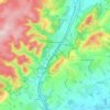
Aston Munslow topographic map

Click on the map to display elevation.

About this map

Name: Aston Munslow topographic map, elevation, terrain.

Location: Aston Munslow, Munslow, Shropshire, England, SY7 9ER, United Kingdom (52.45617 -2.74093 52.49617 -2.70093)

Average elevation: 168 m

Minimum elevation: 104 m

Maximum elevation: 325 m

Other topographic maps

Click on a map to view its topography, its elevation and its terrain.
Broseley

United Kingdom > England > Shropshire

Average elevation: 142 m

Church Stretton

United Kingdom > England > Shropshire

Average elevation: 280 m

Aston Botterell

United Kingdom > England > Shropshire

Average elevation: 203 m

Gear up for your next adventure:

🛏️Camping Sleeping Mat - Comfortable mats for sleeping outdoors
🕶️Polarized Sunglasses - Protect your eyes with durable polarized lenses
🧥Waterproof Jacket - Lightweight rain jackets for hiking and outdoor activities
🥾Trail Hiking Boots - Supportive boots for rough trails
🥾Trail Hiking Shoes - Durable shoes designed for rugged trails

As an Amazon Associate, this site earns from qualifying purchases at no extra cost to you.