Geolocate

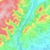
Chirbury topographic map

Click on the map to display elevation.

About this map

Name: Chirbury topographic map, elevation, terrain.

Location: Chirbury, Shropshire, England, SY15 6EP, United Kingdom (52.55886 -3.11100 52.59886 -3.07100)

Average elevation: 125 m

Minimum elevation: 74 m

Maximum elevation: 253 m

Other topographic maps

Click on a map to view its topography, its elevation and its terrain.
Broseley

United Kingdom > England > Shropshire

Average elevation: 142 m

Church Stretton

United Kingdom > England > Shropshire

Average elevation: 280 m

Aston Botterell

United Kingdom > England > Shropshire

Average elevation: 203 m

Gear up for your next adventure:

🧥Softshell Hiking Jacket - The perfect balance of wind protection and breathability
🥾Approach Boots - Comfortable boots for hiking and climbing approaches
🧤Insulated Winter Gloves - Heavy-duty protection for sub-zero Canadian adventures
🔥Emergency Fire Starter - Reliable ignition source for all weather conditions
🧭GPS Outdoor Watch - Smart watch for navigation and fitness tracking in nature

As an Amazon Associate, this site earns from qualifying purchases at no extra cost to you.