Geolocate

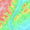
Fitz topographic map

Click on the map to display elevation.

About this map

Name: Fitz topographic map, elevation, terrain.

Location: Fitz, Shropshire, England, SY4 3BG, United Kingdom (52.73593 -2.83878 52.77593 -2.79878)

Average elevation: 74 m

Minimum elevation: 48 m

Maximum elevation: 104 m

Other topographic maps

Click on a map to view its topography, its elevation and its terrain.
Broseley

United Kingdom > England > Shropshire

Average elevation: 142 m

Church Stretton

United Kingdom > England > Shropshire

Average elevation: 280 m

Aston Botterell

United Kingdom > England > Shropshire

Average elevation: 203 m

Gear up for your next adventure:

🧳Compression Sacks - Maximize space in your backpack by shrinking gear
🧤Rechargeable Heated Gloves - Extreme warmth for Canadian winter expeditions
🧣Evaporative Cooling Towel - Beat the heat during intense summer climbs
🥘Camping Cookware Set - Compact nesting pots and pans for trail cooking
🧦Hiking Liner Socks - Thin base layer to prevent friction and blisters

As an Amazon Associate, this site earns from qualifying purchases at no extra cost to you.