Geolocate

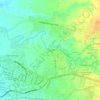
Zone 4 topographic map

Click on the map to display elevation.

About this map

Name: Zone 4 topographic map, elevation, terrain.

Location: Zone 4, Abella, Naga, Bicol Region, 4400, Philippines (13.62381 123.17794 13.62546 123.18139)

Average elevation: 4 m

Minimum elevation: -1 m

Maximum elevation: 10 m

Other topographic maps

Click on a map to view its topography, its elevation and its terrain.

San Isidro

Philippines > Naga

Average elevation: 86 m

Zone 5

Philippines > Naga > Panicuason

Average elevation: 338 m

Naga River

Philippines > Naga

Average elevation: 26 m

Panicuason

Philippines > Naga

Average elevation: 338 m

ALMEDA PUMPING STATION

Philippines > Naga

Average elevation: 24 m

Naga River

Philippines > Naga

Average elevation: 36 m

Carolina

Philippines > Naga

Average elevation: 183 m

San Isidro

Philippines > Naga

Average elevation: 86 m

Panicuason

Philippines > Naga

Average elevation: 335 m

Panicuason

Philippines > Naga

Average elevation: 335 m

Carolina

Philippines > Naga

Average elevation: 183 m

Panicuason

Philippines > Naga

Average elevation: 335 m

Gear up for your next adventure:

🛶Waterproof Dry Bags - Keep electronics and clothes dry during river crossings
🐕Hiking Dog Pack - Let your canine companion carry their own water and food
🦶Anti-Blister Balm - Prevents friction and hotspots during long ascents
🥾Lightweight Hiking Shoes - Comfortable shoes for day hikes
🥾Trekking Poles - Adjustable trekking poles to reduce knee stress and improve stability

As an Amazon Associate, this site earns from qualifying purchases at no extra cost to you.