Geolocate

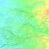
Panicuason topographic map

Click on the map to display elevation.

About this map

Name: Panicuason topographic map, elevation, terrain.

Location: Panicuason, Naga, Bicol Region, 4400, Philippines (13.64329 123.29792 13.68329 123.33792)

Average elevation: 335 m

Minimum elevation: 182 m

Maximum elevation: 588 m

Other topographic maps

Click on a map to view its topography, its elevation and its terrain.
Naga River

Philippines > Naga

Average elevation: 26 m

ALMEDA PUMPING STATION

Philippines > Naga

Average elevation: 24 m

Naga River

Philippines > Naga

Average elevation: 36 m

Zone 4

Philippines > Naga

Average elevation: 4 m

Zone 4

Philippines > Naga

Average elevation: 4 m

Gear up for your next adventure:

🥾Trekking Poles - Adjustable trekking poles to reduce knee stress and improve stability
🥾Light Hiking Boots - Lightweight and comfortable boots for day hikes
🛏️Sleeping Bag - Warm and compact sleeping bags for outdoor camping
🧴Bear Spray Holster - Quick-access carry for essential Canadian wilderness safety
🔋Lithium AA Batteries - Long-lasting power that performs in extreme cold

As an Amazon Associate, this site earns from qualifying purchases at no extra cost to you.