Geolocate

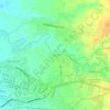
Carolina topographic map

Click on the map to display elevation.

About this map

Name: Carolina topographic map, elevation, terrain.

Location: Carolina, Naga, Bicol Region, 4400, Philippines (13.64433 123.27086 13.68433 123.31086)

Average elevation: 183 m

Minimum elevation: 97 m

Maximum elevation: 301 m

Other topographic maps

Click on a map to view its topography, its elevation and its terrain.
Naga River

Philippines > Naga

Average elevation: 26 m

ALMEDA PUMPING STATION

Philippines > Naga

Average elevation: 24 m

Naga River

Philippines > Naga

Average elevation: 36 m

Zone 4

Philippines > Naga

Average elevation: 4 m

Zone 4

Philippines > Naga

Average elevation: 4 m

Gear up for your next adventure:

🧢Hiking Sun Hat - Wide-brimmed protection for exposed mountain ridges
🌬️Windproof Camp Stove - Efficient cooking even on exposed mountain peaks
🦯Trekking Poles - Reduced impact on joints for steep topographic climbs
💡Solar Camping Lamp - Eco-friendly lighting for campsites
🧦Hiking Socks - Moisture-wicking and comfortable socks for long hikes

As an Amazon Associate, this site earns from qualifying purchases at no extra cost to you.