Geolocate

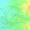
Carolina topographic map

Click on the map to display elevation.

About this map

Name: Carolina topographic map, elevation, terrain.

Location: Carolina, Naga, Bicol Region, 4400, Philippines (13.64433 123.27086 13.68433 123.31086)

Average elevation: 183 m

Minimum elevation: 97 m

Maximum elevation: 301 m

Other topographic maps

Click on a map to view its topography, its elevation and its terrain.
Naga River

Philippines > Naga

Average elevation: 26 m

ALMEDA PUMPING STATION

Philippines > Naga

Average elevation: 24 m

Naga River

Philippines > Naga

Average elevation: 36 m

Zone 4

Philippines > Naga

Average elevation: 4 m

Zone 4

Philippines > Naga

Average elevation: 4 m

Gear up for your next adventure:

👖Convertible Hiking Pants - Zip-off legs to adapt to changing weather conditions
🪜Heavy Duty Carabiners - Multi-use clips for securing gear to your backpack
🧥Packable Rain Jacket - Breathable waterproof layer for unpredictable weather
🥤Collapsible Travel Cup - Saves space and weight in your mess kit
💡LED Headlamp - Hands-free illumination for night hiking and camping

As an Amazon Associate, this site earns from qualifying purchases at no extra cost to you.