Geolocate

Tower topographic map

Click on the map to display elevation.

About this map

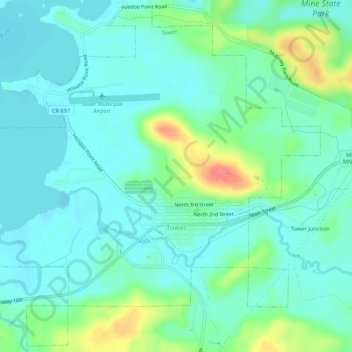
Name: Tower topographic map, elevation, terrain.

Location: Tower, Saint Louis County, Minnesota, United States (47.79279 -92.30833 47.82762 -92.25471)

Average elevation: 427 m

Minimum elevation: 410 m

Maximum elevation: 479 m

Other topographic maps

Click on a map to view its topography, its elevation and its terrain.

Toivola

United States > Minnesota > Saint Louis County

Average elevation: 392 m

Hibbing

United States > Minnesota > Saint Louis County > Hibbing > Hibbing

Average elevation: 454 m

Canyon

United States > Minnesota > Saint Louis County > Canyon

Average elevation: 411 m

Whiteface

United States > Minnesota > Saint Louis County

Average elevation: 418 m

City park

United States > Minnesota > Saint Louis County > Duluth

Average elevation: 206 m

Gheen

United States > Minnesota > Saint Louis County > Gheen

Average elevation: 411 m

Munger

United States > Minnesota > Saint Louis County > Munger

Average elevation: 416 m

Cotton

United States > Minnesota > Saint Louis County > Cotton

Average elevation: 405 m

Gear up for your next adventure:

🔋Emergency Crank Radio - Weather alerts and power without needing batteries
🧰Multitool Knife - Compact and versatile tool for outdoor use
🧥Thermal Fleece Jacket - Versatile insulation for changing mountain temperatures
📷Outdoor Action Camera - Capture high-elevation views and rugged adventures
🧴First Aid Kit - Essential first aid supplies for outdoor emergencies

As an Amazon Associate, this site earns from qualifying purchases at no extra cost to you.