Geolocate

Hibbing topographic map

Click on the map to display elevation.

About this map

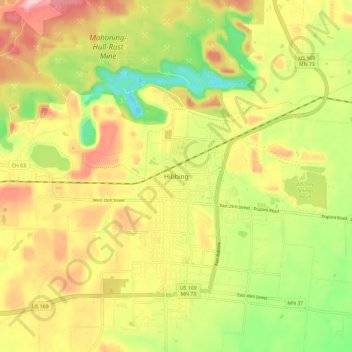
Name: Hibbing topographic map, elevation, terrain.

Location: Hibbing, Saint Louis County, Minnesota, 55746, United States (47.38716 -92.97769 47.46716 -92.89769)

Average elevation: 454 m

Minimum elevation: 357 m

Maximum elevation: 551 m

Gear up for your next adventure:

🛁Quick-Dry Microfiber Towel - Space-saving towel that dries rapidly on the move
🧴First Aid Kit - Essential first aid supplies for outdoor emergencies
🛰️Satellite Messenger - Emergency communication for areas with no cell service
💡LED Camping Lantern - Illuminate your campsite with long-lasting lanterns
🧰Emergency Multi-Tool - Compact multi-tool for outdoor survival

As an Amazon Associate, this site earns from qualifying purchases at no extra cost to you.