Geolocate

Jackson topographic map

Click on the map to display elevation.

Jackson

Jackson is located at an elevation of 6,237 feet (1,901 m) above sea level. According to the United States Census Bureau, the town has a total area of 2.95 square miles (7.64 km2), of which 2.91 square miles (7.54 km2) is land and 0.04 square miles (0.10 km2) is water.

Wikipedia (CC-BY-SA 3.0)

About this map

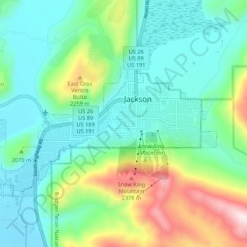
Name: Jackson topographic map, elevation, terrain.

Location: Jackson, Teton County, Wyoming, 83002, United States (43.45819 -110.81343 43.49046 -110.73764)

Average elevation: 2,043 m

Minimum elevation: 1,857 m

Maximum elevation: 2,511 m

Other topographic maps

Click on a map to view its topography, its elevation and its terrain.

Porcupine Hills

United States > Wyoming > Teton County

Average elevation: 2,223 m

Moose Mountain

United States > Wyoming > Teton County

Average elevation: 2,821 m

West Thumb

United States > Wyoming > Teton County

Average elevation: 2,383 m

Phelps Lake

United States > Wyoming > Teton County

Average elevation: 2,084 m

Battleship Mountain

United States > Wyoming > Teton County

Average elevation: 2,924 m

White Dome Geyser

United States > Wyoming > Teton County

Average elevation: 2,255 m

Gear up for your next adventure:

🔋Emergency Crank Radio - Weather alerts and power without needing batteries
🧢Outdoor Cap - Protective cap for sun and rain during hikes
🚲Handlebar Phone Mount - View topographic-map.com live while cycling
👟Trail Running Shoes - Agile footwear for fast-paced topographic exploration
🥾Trail Running Shoes - Lightweight and durable shoes for trail running

As an Amazon Associate, this site earns from qualifying purchases at no extra cost to you.