
Iskut River topographic map
Click on the map to display elevation.
About this map
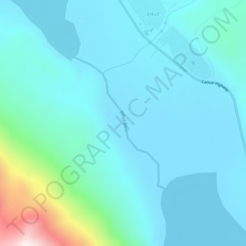
Name: Iskut River topographic map, elevation, terrain.
Average elevation: 932 m
Minimum elevation: 821 m
Maximum elevation: 1,621 m
Regional District of Kitimat-Stikine trails, hiking, mountain biking, running and outdoor activities
Other topographic maps
Click on a map to view its topography, its elevation and its terrain.
Iskut
Canada > British Columbia > Regional District of Kitimat-Stikine > Area D (Iskut/Big Raven)
Average elevation: 930 m
Tumeka Lake
Canada > British Columbia > Regional District of Kitimat-Stikine > Area D (Iskut/Big Raven)
Average elevation: 1,382 m
Mount Edziza
Canada > British Columbia > Regional District of Kitimat-Stikine > Area D (Iskut/Big Raven)
Mount Edziza (/ədˈzaɪzə/ əd-ZY-zə; Tahltan: Tenh Dẕetle [ten̥ ˈdðetle]) is a volcanic mountain in Cassiar Land District of northwestern British Columbia, Canada. It is located on the Big Raven Plateau of the Tahltan Highland which extends along the western side of the Stikine Plateau. Mount Edziza…
Average elevation: 2,530 m
Hoodoo Mountain
Canada > British Columbia > Regional District of Kitimat-Stikine > Area D (Iskut/Big Raven)
Hoodoo Mountain, sometimes referred to as Hoodoo Volcano, is a potentially active stratovolcano in the Northern Interior of British Columbia, Canada. It is located 25 kilometres (16 miles) northeast of the Alaska–British Columbia border on the north side of the Iskut River opposite of the mouth of the Craig…
Average elevation: 1,657 m
Bob Quinn Lake
Canada > British Columbia > Regional District of Kitimat-Stikine > Area D (Iskut/Big Raven)
Average elevation: 585 m
40 Mile Flats
Canada > British Columbia > Regional District of Kitimat-Stikine > Area D (Iskut/Big Raven)
Average elevation: 1,105 m
Eve Cone
Canada > British Columbia > Regional District of Kitimat-Stikine > Area D (Iskut/Big Raven)
Eve Cone, sometimes referred to as Eve's Cone, is a cinder cone in Cassiar Land District of northwestern British Columbia, Canada. It has an elevation of 1,740 metres (5,710 feet) and is one of several volcanic cones in the Desolation Lava Field at the northern end of the Big Raven Plateau. The cone is…
Average elevation: 1,607 m
Cocoa Crater
Canada > British Columbia > Regional District of Kitimat-Stikine > Area D (Iskut/Big Raven)
Cocoa Crater, sometimes called Cocoa Cone, is a cinder cone in Cassiar Land District of northwestern British Columbia, Canada. It has an elevation of 2,117 metres (6,946 feet) and is one of several volcanic cones in the Snowshoe Lava Field at the southern end of the Big Raven Plateau. The cone is southeast of…
Average elevation: 1,933 m
Coffee Crater
Canada > British Columbia > Regional District of Kitimat-Stikine > Area D (Iskut/Big Raven)
Coffee Crater is a cinder cone in Cassiar Land District of northwestern British Columbia, Canada. It has an elevation of 2,000 metres (6,600 feet) and is one of several volcanic cones in the Snowshoe Lava Field at the southern end of the Big Raven Plateau. The cone is southeast of the community of Telegraph…
Average elevation: 1,888 m
Spectrum Range
Canada > British Columbia > Regional District of Kitimat-Stikine > Area D (Iskut/Big Raven)
Average elevation: 1,669 m
Dawes Glacier
Canada > British Columbia > Regional District of Kitimat-Stikine > Area D (Iskut/Big Raven)
Average elevation: 1,348 m
Telegraph Creek
Canada > British Columbia > Regional District of Kitimat-Stikine > Area D (Iskut/Big Raven)
Average elevation: 461 m
Hoodoo Mountain
Canada > British Columbia > Regional District of Kitimat-Stikine > Area D (Iskut/Big Raven)
Hoodoo Mountain, sometimes referred to as Hoodoo Volcano, is a potentially active stratovolcano in the Northern Interior of British Columbia, Canada. It is located 25 kilometres (16 miles) northeast of the Alaska–British Columbia border on the north side of the Iskut River opposite of the mouth of the Craig…
Average elevation: 1,657 m
Devils Thumb
Canada > British Columbia > Regional District of Kitimat-Stikine > Area D (Iskut/Big Raven)
Average elevation: 1,718 m
Devils Thumb
Canada > British Columbia > Regional District of Kitimat-Stikine > Area D (Iskut/Big Raven)
Average elevation: 1,718 m