Geolocate

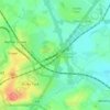
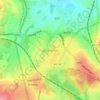
Lichfield topographic map

Click on the map to display elevation.

About this map
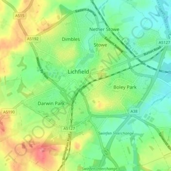
Name: Lichfield topographic map, elevation, terrain.

Location: Lichfield, Staffordshire, England, United Kingdom (52.65791 -1.86523 52.70326 -1.79271)

Average elevation: 91 m

Minimum elevation: 61 m

Maximum elevation: 140 m

Other topographic maps

Click on a map to view its topography, its elevation and its terrain.

Watford Gap

United Kingdom > England > Staffordshire > Lichfield

Average elevation: 131 m

Fradley

United Kingdom > England > Staffordshire > Lichfield

Average elevation: 59 m

Chasetown

United Kingdom > England > Staffordshire > Lichfield

Average elevation: 155 m

Hopwas

United Kingdom > England > Staffordshire > Lichfield

Average elevation: 82 m

Streethay

United Kingdom > England > Staffordshire > Lichfield

Average elevation: 73 m

Handsacre

United Kingdom > England > Staffordshire > Lichfield

Average elevation: 74 m

Croxall

United Kingdom > England > Staffordshire > Lichfield

Average elevation: 57 m

Little Aston

United Kingdom > England > Staffordshire > Lichfield

Average elevation: 142 m

Edingale

United Kingdom > England > Staffordshire > Lichfield

Average elevation: 63 m

Beacon Park

United Kingdom > England > Staffordshire > Lichfield

Average elevation: 93 m

Lynn

United Kingdom > England > Staffordshire > Lichfield > Stonnall

Average elevation: 128 m

Gentleshaw

United Kingdom > England > Staffordshire > Lichfield > Longdon

Average elevation: 174 m

Armitage

United Kingdom > England > Staffordshire > Lichfield

Average elevation: 80 m

Aldershawe

United Kingdom > England > Staffordshire > Lichfield

Average elevation: 102 m

Pipehill

United Kingdom > England > Staffordshire > Lichfield > Woodhouses

Average elevation: 111 m

Watford Gap

United Kingdom > England > Staffordshire > Lichfield

Average elevation: 131 m

Watford Gap

United Kingdom > England > Staffordshire > Lichfield

Average elevation: 131 m

Handsacre

United Kingdom > England > Staffordshire > Lichfield

Average elevation: 77 m

Gear up for your next adventure:

⛺Tent Footprint - Protect tent floor and increase durability
🧥Ultralight Puffy Jacket - Maximum warmth that packs down to the size of an orange
👟Sport Hiking Sandals - Breathable footwear for water crossings and camp rest
🧢Outdoor Cap - Protective cap for sun and rain during hikes
🚲Handlebar Phone Mount - View topographic-map.com live while cycling

As an Amazon Associate, this site earns from qualifying purchases at no extra cost to you.