
Tinggimoncong topographic map
Click on the map to display elevation.
About this map
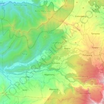
Name: Tinggimoncong topographic map, elevation, terrain.
Location: Tinggimoncong, Gowa, South Sulawesi, Sulawesi, Indonesia (-5.30885 119.75466 -5.18397 119.93985)
Average elevation: 973 m
Minimum elevation: 140 m
Maximum elevation: 2,627 m
Other topographic maps
Click on a map to view its topography, its elevation and its terrain.