Geolocate

Pujananting topographic map

Click on the map to display elevation.

About this map

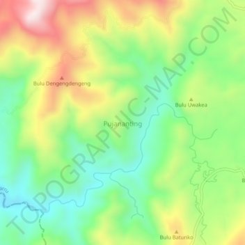
Name: Pujananting topographic map, elevation, terrain.

Location: Pujananting, Barru, South Sulawesi, Sulawesi, Indonesia (-4.72599 119.68458 -4.68599 119.72458)

Average elevation: 323 m

Minimum elevation: 108 m

Maximum elevation: 644 m

Gear up for your next adventure:

🥘Camping Cookware Set - Compact nesting pots and pans for trail cooking
🔨Vehicle Emergency Tool - Safety tool for remote road trips to trailheads
🥾Trail Running Boots - Durable shoes designed for trail running
🧤Thermal Hiking Gloves - Grip-enhanced gloves for cold-weather altitude trekking
💧Hydration Pack - Hands-free hydration system for long hikes

As an Amazon Associate, this site earns from qualifying purchases at no extra cost to you.