
Freathy topographic map
Click on the map to display elevation.
About this map
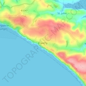
Name: Freathy topographic map, elevation, terrain.
Location: Freathy, St. John, Cornwall, England, PL10 1JP, United Kingdom (50.32745 -4.27160 50.36745 -4.23160)
Average elevation: 37 m
Minimum elevation: 0 m
Maximum elevation: 127 m
Other topographic maps
Click on a map to view its topography, its elevation and its terrain.