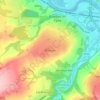
River Wye topographic map
Click on the map to display elevation.
River Wye
The River Wye is protected by two Sites of Special Scientific Interest, one covering the Upper Wye (Gwy Uchaf) above Hay-on-Wye, and one covering the Lower Wye (Gwy Isaf) downstream to Chepstow. The criteria for inclusion of the river as an SSSI include geology, topography, flora, mammals, invertebrates, fish and birdlife, as the river and its tributaries constitute a large linear ecosystem. The Lower Wye SSSI is itself divided into seven units of assessment set by Natural England, and administrative responsibilities are shared between the councils of Powys, Herefordshire, Gloucestershire, and Monmouthshire. The Wye abuts a range of other SSSIs in England and Wales, including the Upper Wye Gorge and Lower Wye Gorge.
About this map

Name: River Wye topographic map, elevation, terrain.
Location: River Wye, England, United Kingdom (51.59470 -3.76468 52.46891 -2.55976)
Average elevation: 207 m
Minimum elevation: 0 m
Maximum elevation: 834 m
Other topographic maps
Click on a map to view its topography, its elevation and its terrain.
Ely
United Kingdom > England > Ely
For over 800 years the cathedral and its associated buildings—built on an elevation 68 feet (21 m) above the nearby fens—have visually influenced the city and its surrounding area. Geographer John Jones, writing in 1924, reports that "from the roof of King's Chapel in Cambridge, on a clear day, Ely can be…
Average elevation: 13 m
Leeds
Lying in the eastern foothills of the Pennines, there is a significant variation in elevation within the city's built-up area. The district ranges from 1,115 feet (340 m) in the far west on the slopes of Ilkley Moor to about 33 feet (10 m) where the rivers Aire and Wharfe cross the eastern boundary. Land rises…
Average elevation: 94 m



Bradford
Bradford is located at 53°45′00″N 01°50′00″W / 53.75000°N 1.83333°W / 53.75000; -1.83333 (53.7500, -1.8333)1. Topographically, it is located in the eastern moorland region of the South Pennines.
Average elevation: 167 m
Swindon
United Kingdom > England > Swindon
Swindon has an oceanic climate (Cfb in the Köppen climate classification), like the vast majority of the British Isles, with cool winters and warm summers. The nearest official weather station is RAF Lyneham, about 10 miles (16 km) west southwest of Swindon town centre. The weather station's elevation is 145…
Average elevation: 108 m
Reading
United Kingdom > England > Reading
Mary Russell Mitford lived in Reading for a number of years and then spent the rest of her life just outside the town at Three Mile Cross and Swallowfield. The fictional Belford Regis of her eponymous novel, first published in 1835, is largely based on Reading. Described with topographical accuracy, it is…
Average elevation: 56 m



Hare Street
United Kingdom > England > Hertfordshire > East Hertfordshire > Great Hormead
Average elevation: 110 m

Pillerton Hersey
United Kingdom > England > Warwickshire > Stratford-on-Avon > Pillerton Hersey
Average elevation: 92 m

Beacon Hill
United Kingdom > England > Norfolk > North Norfolk
Beacon Hill is a part of the Cromer Ridge which is a ridge of old glacial moraines (terminal moraine) that stands next to the coast above Cromer. The Cromer Ridge seems to have been the front line of the ice sheet for some time at the last glaciations, which is shown by the large size of the feature. All the…
Average elevation: 65 m



Donnington Park
United Kingdom > England > West Sussex > Chichester > Donnington
Average elevation: 8 m




Harrogate
United Kingdom > England > North Yorkshire
Harrogate is situated on the edge of the Yorkshire Dales, with the Vale of York to the east and the upland Yorkshire Dales to the west and north-west. It has a dry and mild climate, typical of places in the rain shadow of the Pennines. It is on the A59 from Skipton to York. At an altitude of between 100 and…
Average elevation: 106 m


Newark on Trent
United Kingdom > England > Nottinghamshire > Newark and Sherwood
Average elevation: 18 m

Salisbury
United Kingdom > England > Salisbury
Bishop of Salisbury Hubert Walter was instrumental in the negotiations with Saladin during the Third Crusade, but he spent little time in his diocese prior to his elevation to archbishop of Canterbury. The brothers Herbert and Richard Poore succeeded him and began planning the relocation of the cathedral into…
Average elevation: 96 m
Cambridge
United Kingdom > England > Cambridge
The city, like most of the UK, has a maritime climate highly influenced by the Gulf Stream. Located in the driest region of Britain, Cambridge's rainfall averages around 570 mm (22.44 in) per year, around half the national average, with some years occasionally falling into the semi-arid (under 500 mm (19.69…
Average elevation: 18 m


Salford
At 53°28′59″N 2°17′35″W / 53.48306°N 2.29306°W / 53.48306; -2.29306 (53.483°, −2.2931°), and 205 miles (330 km) northwest of central London, Salford stands about 177 feet (54 m) above sea level, on relatively flat ground to the west of a meander of the River Irwell – the city's main…
Average elevation: 106 m


Dorchester-on-Thames
United Kingdom > England > Oxfordshire > South Oxfordshire
Average elevation: 54 m


Mardleybury
United Kingdom > England > Hertfordshire > Welwyn Hatfield > Woolmer Green
Average elevation: 109 m





Cambridge
United Kingdom > England > Cambridgeshire
The city, like most of the UK, has a maritime climate highly influenced by the Gulf Stream. Located in the driest region of Britain, Cambridge's rainfall averages around 570 mm (22.44 in) per year, around half the national average, The driest recent year was in 2011 with 380.4 mm (14.98 in) of rain at the…
Average elevation: 33 m