Geolocate

Cheadle topographic map

Click on the map to display elevation.

About this map
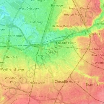
Name: Cheadle topographic map, elevation, terrain.

Location: Cheadle, Stockport, Greater Manchester, England, SK8 1HB, United Kingdom (53.35364 -2.25221 53.43364 -2.17221)

Average elevation: 59 m

Minimum elevation: 23 m

Maximum elevation: 93 m

Other topographic maps

Click on a map to view its topography, its elevation and its terrain.

Gear up for your next adventure:

💧Hydration Pack - Hands-free hydration system for long hikes
🧴Insect Repellent - Protect yourself from bugs during outdoor adventures
🧳Compression Sacks - Maximize space in your backpack by shrinking gear
🥾Lightweight Hiking Shoes - Comfortable shoes for day hikes
🧢Hiking Sun Hat - Wide-brimmed protection for exposed mountain ridges

As an Amazon Associate, this site earns from qualifying purchases at no extra cost to you.