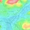
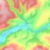
River Teifi topographic map
Click on the map to display elevation.
About this map

Name: River Teifi topographic map, elevation, terrain.
Location: River Teifi, Carmarthenshire, Wales, United Kingdom (52.02674 -4.67312 52.29193 -3.78989)
Average elevation: 155 m
Minimum elevation: 0 m
Maximum elevation: 600 m
Other topographic maps
Click on a map to view its topography, its elevation and its terrain.









National Botanic Garden of Wales
United Kingdom > Wales > Carmarthenshire > Llanarthney
Average elevation: 90 m
Tycroes
United Kingdom > Wales > Carmarthenshire
Topographically, the village slopes in a general south west to north east direction thus affording panoramic views of the Black Mountain in the east with its peaks - Tair Cairn 482 m, Garreg Lwyd 616 m and behind them Fan Hir 802 m. To the south there are views from Betws Mountain to Mynydd y Gwair above…
Average elevation: 81 m