Geolocate

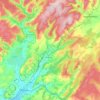
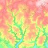
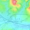
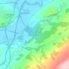
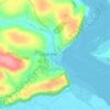
Llangennech topographic map

Click on the map to display elevation.

About this map

Name: Llangennech topographic map, elevation, terrain.

Location: Llangennech, Carmarthenshire, Wales, SA14 8TS, United Kingdom (51.67600 -4.10347 51.71600 -4.06347)

Average elevation: 37 m

Minimum elevation: -3 m

Maximum elevation: 128 m

Other topographic maps

Click on a map to view its topography, its elevation and its terrain.
Cynwyl Gaeo

United Kingdom > Wales > Carmarthenshire

Average elevation: 254 m

Bryn Iwan

United Kingdom > Wales > Carmarthenshire

Average elevation: 252 m

Whitland

United Kingdom > Wales > Carmarthenshire

Average elevation: 52 m

River Towy

United Kingdom > Wales > Carmarthenshire

Average elevation: 215 m

Llanedi

United Kingdom > Wales > Carmarthenshire > Llanedi

Average elevation: 104 m

Llanwinio

United Kingdom > Wales > Carmarthenshire

Average elevation: 164 m

Llannon

United Kingdom > Wales > Carmarthenshire > Llannon

Average elevation: 144 m

Meidrim

United Kingdom > Wales > Carmarthenshire

Average elevation: 91 m

Llanycrwys

United Kingdom > Wales > Carmarthenshire

Average elevation: 248 m

Afon Bran

United Kingdom > Wales > Carmarthenshire > Llangadog

Average elevation: 57 m

Whitland

United Kingdom > Wales > Carmarthenshire > Whitland

Average elevation: 43 m

Trelech

United Kingdom > Wales > Carmarthenshire

Average elevation: 182 m

Rhos

United Kingdom > Wales > Carmarthenshire > Rhos

Average elevation: 206 m

Llyn Taliaris

United Kingdom > Wales > Carmarthenshire

Average elevation: 167 m

Whitland

United Kingdom > Wales > Carmarthenshire

Average elevation: 42 m

Cilycwm

United Kingdom > Wales > Carmarthenshire

Average elevation: 256 m

Coed Tregib

United Kingdom > Wales > Carmarthenshire > Llandeilo

Average elevation: 82 m

Llyn y Fan Fach

United Kingdom > Wales > Carmarthenshire

Llyn y Fan Fach (Welsh meaning "little lake of the peak") is a lake of approximately 10 hectares (25 acres) on the northern margin of the Black Mountain in Carmarthenshire, South Wales and lying within the Brecon Beacons National Park. The lake lies at an altitude of approximately 1,660 feet (510 m),…

Average elevation: 549 m

River Teifi

United Kingdom > Wales > Carmarthenshire

Average elevation: 155 m

Llyn Taliaris

United Kingdom > Wales > Carmarthenshire > Salem

Average elevation: 167 m

Abernant

United Kingdom > Wales > Carmarthenshire

Average elevation: 158 m

Llanedi

United Kingdom > Wales > Carmarthenshire > Llanedi

Average elevation: 104 m

Gear up for your next adventure:

🧭GPS Tracker - Track your location in remote areas safely
🥾Light Hiking Boots - Lightweight and comfortable boots for day hikes
🧭Orienteering Kit - Tools for map reading and navigation in the wild
⛺Bushcraft Tarp - Versatile emergency shelter or gear protection
🥾Lightweight Hiking Boots - Boots for comfort and mobility on long hikes

As an Amazon Associate, this site earns from qualifying purchases at no extra cost to you.