Geolocate

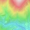
Gombrèn topographic map

Click on the map to display elevation.

About this map

Name: Gombrèn topographic map, elevation, terrain.

Location: Gombrèn, Ripollès, Girona, Catalonia, Spain (42.21479 2.01712 42.29160 2.12425)

Average elevation: 1,246 m

Minimum elevation: 758 m

Maximum elevation: 2,046 m

Other topographic maps

Click on a map to view its topography, its elevation and its terrain.
Molló

Spain > Catalonia > Ripollès > Molló > Molló

Average elevation: 1,239 m

Puigmal

Spain > Catalonia > Ripollès > Queralbs

Average elevation: 2,572 m

Rama

Spain > Catalonia > Ripollès > Ripoll

Average elevation: 851 m

Cabanes de la Serra

Spain > Catalonia > Ripollès > Setcases

Average elevation: 1,661 m

Beget

Spain > Catalonia > Ripollès > Camprodon

Average elevation: 761 m

Faldar de Pas dels Lladres

Spain > Catalonia > Ripollès > Toses

Average elevation: 1,459 m

el Tor

Spain > Catalonia > Ripollès > Gombrèn

Average elevation: 1,152 m

Espinavell

Spain > Catalonia > Ripollès > Molló

Average elevation: 1,431 m

Gear up for your next adventure:

🧴Waterproofing Spray - Restore the DWR coating on jackets and tents
🚑Survival Whistle - Signal for help across long distances in mountains
🥾Trail Hiking Shoes - Durable shoes designed for rugged trails
🛏️Camping Sleeping Mat - Comfortable mats for sleeping outdoors
🥾Approach Boots - Comfortable boots for hiking and climbing approaches

As an Amazon Associate, this site earns from qualifying purchases at no extra cost to you.