Geolocate

Rama topographic map

Click on the map to display elevation.

About this map

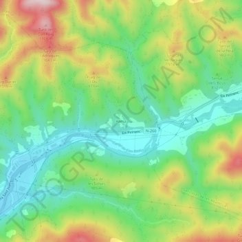
Name: Rama topographic map, elevation, terrain.

Location: Rama, Ripoll, Ripollès, Girona, Catalonia, 17500, Spain (42.20143 2.20634 42.24143 2.24634)

Average elevation: 851 m

Minimum elevation: 691 m

Maximum elevation: 1,115 m

Gear up for your next adventure:

🧦Merino Wool Socks - Moisture-wicking comfort for long-distance hiking
🔪Outdoor Multitool - Versatile tool for repairs and food prep in the wild
🌬️Windproof Camp Stove - Efficient cooking even on exposed mountain peaks
🧦Outdoor Socks - Durable socks designed for hiking and outdoor sports
🧤Thermal Hiking Gloves - Grip-enhanced gloves for cold-weather altitude trekking

As an Amazon Associate, this site earns from qualifying purchases at no extra cost to you.