Geolocate

Beget topographic map

Click on the map to display elevation.

About this map

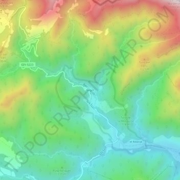
Name: Beget topographic map, elevation, terrain.

Location: Beget, Camprodon, Ripollès, Girona, Catalonia, 17867, Spain (42.30088 2.46015 42.34088 2.50015)

Average elevation: 761 m

Minimum elevation: 445 m

Maximum elevation: 1,336 m

Gear up for your next adventure:

🛶Kayak Dry Bag - Waterproof storage for kayaking adventures
🌬️Windproof Camp Stove - Efficient cooking even on exposed mountain peaks
🧶550 Survival Paracord - Versatile utility cord for emergency repairs and rigging
🔦LED Flashlight - Powerful and long-lasting flashlight for camping and emergencies
🛁Quick-Dry Microfiber Towel - Space-saving towel that dries rapidly on the move

As an Amazon Associate, this site earns from qualifying purchases at no extra cost to you.