Geolocate

Espinavell topographic map

Click on the map to display elevation.

About this map

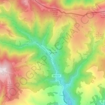
Name: Espinavell topographic map, elevation, terrain.

Location: Espinavell, Molló, Ripollès, Girona, Catalonia, 17868, Spain (42.35811 2.37856 42.39811 2.41856)

Average elevation: 1,431 m

Minimum elevation: 1,106 m

Maximum elevation: 1,736 m

Gear up for your next adventure:

🗺️Topographic Maps - Detailed maps to explore trails, mountains, and wilderness areas
🥤Collapsible Travel Cup - Saves space and weight in your mess kit
🚲Handlebar Phone Mount - View topographic-map.com live while cycling
🧰Multitool Knife - Compact and versatile tool for outdoor use
🧢Outdoor Cap - Protective cap for sun and rain during hikes

As an Amazon Associate, this site earns from qualifying purchases at no extra cost to you.