
Mochau topographic map
Click on the map to display elevation.
About this map
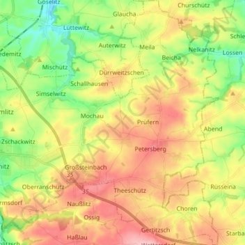
Name: Mochau topographic map, elevation, terrain.
Location: Mochau, Döbeln, Mittelsachsen, Sachsen, Deutschland (51.08913 13.14544 51.17577 13.25907)
Average elevation: 232 m
Minimum elevation: 157 m
Maximum elevation: 313 m
Other topographic maps
Click on a map to view its topography, its elevation and its terrain.
Großsteinbach
Deutschland > Sachsen > Mittelsachsen > Döbeln
Symbolik: Die Mauer stellt die ehemalige mittelalterliche Stadtbefestigung dar. Die Stadttore symbolisieren das Ober-, Nieder- und Staupitztor. Der mittlere höhere Turm soll wohl auf die Burg hinweisen. Das Wappen ist seit 1992 in dieser Form gültig. Das vorhergehende ähnliche Wappen, gültig von 1894 bis…
Average elevation: 249 m