Geolocate

Thal topographic map

Click on the map to display elevation.

About this map

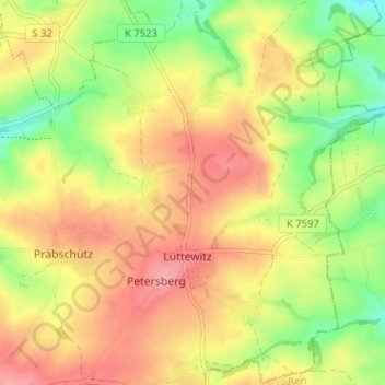
Name: Thal topographic map, elevation, terrain.

Location: Thal, Mochau, Döbeln, Mittelsachsen, Sachsen, Deutschland (51.11240 13.20653 51.15240 13.24653)

Average elevation: 247 m

Minimum elevation: 197 m

Maximum elevation: 289 m

Gear up for your next adventure:

🧢Outdoor Cap - Protective cap for sun and rain during hikes
🧦Crew Hiking Socks - Comfortable socks for long-distance hikes
🧢Sun Hat - Wide-brim hat for sun protection
🧥Waterproof Pants - Keep dry during rainy hiking conditions
🧳Compression Sacks - Maximize space in your backpack by shrinking gear

As an Amazon Associate, this site earns from qualifying purchases at no extra cost to you.