Geolocate

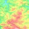
Großsteinbach topographic map

Click on the map to display elevation.

Großsteinbach

Symbolik: Die Mauer stellt die ehemalige mittelalterliche Stadtbefestigung dar. Die Stadttore symbolisieren das Ober-, Nieder- und Staupitztor. Der mittlere höhere Turm soll wohl auf die Burg hinweisen. Das Wappen ist seit 1992 in dieser Form gültig. Das vorhergehende ähnliche Wappen, gültig von 1894 bis 1992, hatte lediglich blaue Türme.

Wikipedia (CC-BY-SA 3.0)

About this map

Name: Großsteinbach topographic map, elevation, terrain.

Location: Großsteinbach, Döbeln, Jahnatal, Mittelsachsen, Sachsen, 04720, Deutschland (51.09671 13.16395 51.13671 13.20395)

Average elevation: 249 m

Minimum elevation: 200 m

Maximum elevation: 292 m

Other topographic maps

Click on a map to view its topography, its elevation and its terrain.
Ebersbach

Deutschland > Sachsen > Mittelsachsen > Döbeln

Average elevation: 240 m

Mochau

Deutschland > Sachsen > Mittelsachsen > Döbeln

Average elevation: 232 m

Gear up for your next adventure:

Lightweight Backpacking Tent - Compact tent for efficient hiking trips
🥾All-Terrain Hiking Boots - Versatile boots for varied hiking conditions
🛏️Sleeping Bag - Warm and compact sleeping bags for outdoor camping
🧣Merino Neck Gaiter - Protects against wind, sun, and cold at high altitudes
🪑Ultralight Camping Stool - Compact seating for rest stops during long hikes

As an Amazon Associate, this site earns from qualifying purchases at no extra cost to you.